

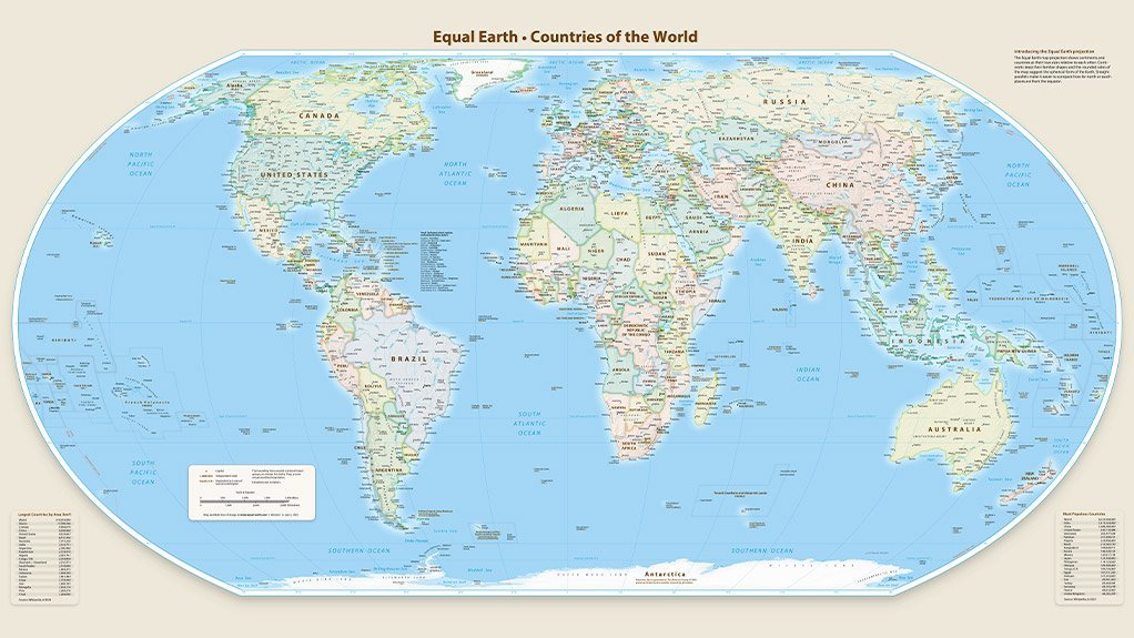
The thirty-ninth Ordinary Session of the Assembly of the African Union (AU) has voted to adopt the Equal Earth projection for maps, on the grounds that it is a more fair and proportionate method of showing Africa’s true size and geographical significance in the world. Other projections, most notably the widely-used Mercator projection, make Africa – in reality the world’s second biggest continent – look smaller than it really is. This step follows a campaign by a partnership between the Correct the Map, Africa No Filter, and Speak Up Africa initiatives.
“We need a new political map of Africa that shows its true size and place in the world,” pointed out Togolese Foreign Minister Professor Robert Dussey. “A fair representation of Africa is essential for global awareness, education, and geopolitical understanding.”
“We are pleased to be part of this historic moment,” affirmed Africa No Filter executive director Moky Makura. “When Africa comes together to correct long-standing distortions, we move the continent forward. Accurate representation is not just about maps, it is about agency, progress, and ensuring the world sees Africa as it truly is.”
The AU Assembly, in making its decision, noted that other map projections had undermined international comprehension of Africa’s true size, significance, economic realities and developmental opportunities. The Mercator projection was specifically referenced, in this regard. (Mercator significantly reduced the apparent size of land masses near the equator.)
The Assembly further encouraged member countries to incorporate the Equal Earth projection into their national curricula. It also designated a “Champion” to lead on the implementation of the resolution and on the reporting of the progress made in doing so.
The AU resolution also referred to the call for “cartographic justice” made at the ninth Pan African Congress. It further emphasised the connection between accurate maps, African identity and the African Renaissance.
The overall intent was to counter long-existing distortions, from colonial cartography, to help achieve “cognitive justice”, to repair the narrative about Africa, and to make clear the continent’s strategic visibility on the world stage. The continent had to be seen, had to recognised as central, huge and important.
EMAIL THIS ARTICLE SAVE THIS ARTICLE ARTICLE ENQUIRY FEEDBACK
To subscribe email subscriptions@creamermedia.co.za or click here
To advertise email advertising@creamermedia.co.za or click here